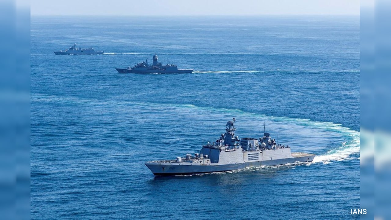
A few hundred miles off the coast of the Andaman Islands, the water changes color. It moves from a bright, shallow turquoise to a deep, bruising navy. Underneath that line of ink lies a trench, and inside that trench, the quietest chess match in modern history is playing out.
If you stood on the deck of a commercial container ship cutting through the Malacca Strait today, you would see nothing but gray water and rusted steel. You might hear the low, rhythmic thrum of the vessel’s engines. But underneath that noise is a vast, digital silence. A network of sensors, deep-sea cables, and coordinated naval patrols is reshaping the map of the world without firing a single shot.
For decades, we looked at the map of global power and saw a teeter-totter. On one side sat Washington; on the other, Beijing. We assumed every smaller nation in the Indo-Pacific was merely a spectator, waiting to see which way the board would tilt. We were wrong.
A quiet transformation is happening right now. It does not look like the sudden, explosive conflicts we watch on the evening news. It looks like a series of boring meetings, shared satellite feeds, and small, strategic naval docks being built in places most people cannot find on an atlas. At the absolute center of this shift is New Delhi.
To understand how we got here, we have to look past the grand speeches and focus on the concrete. Literally.
The Concrete and the Cable
Consider a hypothetical harbor master named Arjun. He works out of a small, sun-bleached concrete office on an island outpost. Ten years ago, his job was mostly bureaucratic paperwork, tracking local fishing trawlers and the occasional stray merchant ship. Today, his terminal blinks with real-time data shared directly with maritime centers in Singapore, Tokyo, and Canberra. He is no longer just watching his own backyard. He is part of a continental tripod.
This is the reality of modern deterrence. It is built on data.
For a long time, India maintained a fierce, historical commitment to non-alignment. It was a proud stance born out of the post-colonial era: we will not take sides, we will not be a pawn in anyone else’s Cold War. But pride faces a hard test when unauthorized research vessels begin mapping the floor of your ocean, looking for the thermal layers where submarines can hide from sonar.
When those vessels started appearing with regularity in the Bay of Bengal, the calculation in New Delhi shifted. The response was not a loud, aggressive declaration of a military alliance. That would be too messy. Instead, India began weaving a web.
It started with tracking systems. By linking its own coastal radar networks with those of neighboring nations like Sri Lanka, the Maldives, and Mauritius, India created a shared glass floor across the western Indian Ocean. If a ship turns off its transponder—a classic tactic for vessels hiding illicit cargo or gathering unauthorized intelligence—the system flags it. Suddenly, the vast, blind spots of the ocean became visible.
Shifting the Center of Gravity
The traditional powers are noticing. Look at the way middle powers are behaving. Australia is spending billions to upgrade its northern bases. Japan is rewriting its defense posture. But neither of them sits at the physical crossroads of global trade. India does.
Every year, more than one-third of the world’s bulk cargo and two-thirds of its oil shipments pass through the Indian Ocean. It is the choke point of the global economy. If those waters become unstable, a factory in Ohio runs out of microchips, and a gas station in Munich runs out of fuel.
Historically, the burden of keeping these lanes open fell almost entirely on the United States Navy. But the American fleet is stretched thin, facing obligations from the North Atlantic to the Red Sea. It cannot be everywhere at once.
That is where the math changes. India is no longer just defending its own coastlines; it is stepping into the role of a regional provider. When pirates re-emerged off the coast of Somalia recently, it wasn't a Western fleet that made the most aggressive, high-profile rescues. It was Indian guided-missile destroyers and commandos. They boarded hijacked vessels, detained pirates, and secured merchant ships flying the flags of dozens of different nations.
This was a message wrapped in a rescue mission. It told the world that the waters connecting the East and the West are no longer a vacuum waiting for an outside superpower to police them.
The Bureaucracy of Survival
The most significant changes are often the hardest to photograph. They happen in windowless rooms where naval officers sign logistics agreements.
Think about what it takes to run a modern navy. A ship is only as good as its fuel tank and its spare parts. If an Indian ship can pull into a Japanese port in Okinawa, use Japanese fuel, and access Japanese maintenance bays—and if a American aircraft carrier can do the same at an Indian base in Visakhapatnam—the geography of the ocean effectively shrinks.
This is the strategic framework that has emerged over the last few years. It is not a formal treaty like NATO. There is no Article 5 stating that an attack on one is an attack on all. It is something much more fluid, and perhaps, much harder for an adversary to counter. It is a network of interlocking bilateral agreements.
- Logistics Sharing: Allowing friendly navies to refuel and resupply at each other’s bases, extending their operational reach by thousands of miles.
- Secure Communications: Installing compatible data links so that an Indian fighter jet can pass target coordinates directly to an American or Australian destroyer without relying on slow, unencrypted radio chains.
- Submarine Tracking: Sharing acoustics data to identify the unique sound signatures of foreign submersibles moving through deep ocean trenches.
This is not a project driven by ideology. It is driven by a shared, cold-eyed assessment of risk. None of these countries want a conflict. In fact, their entire economic futures depend on preventing one. But they have realized that the only way to keep the peace is to make the cost of disrupting it unimaginably high.
The View from the Water
It is easy to get lost in the vocabulary of geopolitics—words like deterrence, architecture, and multi-polarity. But the true weight of this shift is felt by the people who live on the water.
Imagine the captain of a small commercial oil tanker. He is navigating the crowded lanes of the Malacca Strait. To his left and right are dozens of other ships, some three football fields long, all carrying the lifeblood of global commerce. A decade ago, if his ship suffered a mechanical failure or faced an armed threat, his call for help went out into a fragmented void. He had to hope an American carrier strike group was within steaming distance, or that a local coast guard had the budget to send a patrol boat.
Today, that captain operates under a sky filled with shared satellites and an ocean patrolled by a rotating roster of maritime democracies that speak to each other in real-time.
The ocean has not changed. The waves are just as high, the trenches just as deep, and the distances just as punishing. But the invisible lines of connection have multiplied. The quiet revolution in the Indo-Pacific is not about building a new empire or drawing new borders on a map. It is about making sure that the old borders, and the open seas between them, remain exactly as they are.
As the sun sets over the Andaman Sea, the navy-blue water turns to a dull, metallic gray. Somewhere beneath the surface, a propeller spins, pushing a submarine through the darkness. But on the surface, the lights of the cargo ships blink in unison, moving steadily toward the horizon, watched by eyes that are no longer looking at the world alone.