Ink is heavier than it looks. On a printed map, a thin red line looks weightless, a pencil-stroke separation between one county and another, or one block and the next. But ink can carry a house, a church, a grocery store, and forty years of shared history, tossing them across a legal chasm with a flick of a wrist.
Consider a street in Kansas City. On the east side of the avenue, people vote for one representative; on the west side, another. For most of the decade, the residents on the west side shared morning coffees, bus stops, and neighborhood association meetings with the people across the street. Then came the shift. A committee room miles away, lit by fluorescent glare and filled with quiet calculations, moved a boundary two blocks east. Suddenly, the west-side neighbors belong to a district whose heart beats three hours away in a rural county they have never visited, whose economic concerns center on crops they do not grow, and whose representative has never walked their sidewalks.
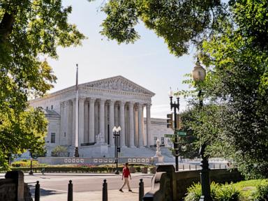
This is the quiet alchemy of redistricting. It happens every ten years, mandated by the census, a constitutional housekeeping task designed to ensure that as populations shift, representation shifts with them. In theory, it is a measure of fairness. In practice, it has become a high-stakes chess match played with human lives as pawns. Nowhere is this tension more visible, or more exhausting, than in Missouri, where the argument over congressional boundaries has returned to the United States Supreme Court for a third time.
To understand why a state's map can drag the highest court in the nation back into its chambers repeatedly, you have to look past the dry legal briefs and see the machinery of power. Power in a democracy is not just about who wins an election; it is about who gets to draw the arena. If you control the pen, you can pack your opponents into a single district where their votes pile up uselessly high, or you can crack them apart, spreading their numbers thin across multiple districts until their collective voice is reduced to a whisper.
Missouri’s recent political geography is a study in this friction. The state sits at a fascinating cultural and demographic crossroads, anchored by two massive urban anchors—Kansas City and St. Louis—and bound by a vast expanse of rural communities. For years, the maps reflected this duality, creating a delicate equilibrium. But equilibrium is terrifying to political strategists whose primary job is to secure permanent advantage.
When the 2020 census forced a redrawing of the lines, the collision between state lawmakers and the judicial system began in earnest. Legislators wanted a map that locked in partisan gains, protecting incumbents and carving up urban centers to dilute their influence. Opponents argued that the proposed configurations trampled on constitutional rights, systematically silencing minority voters and violating the core principle of one person, one vote.
Courts got involved because someone had to hold the ruler. Lower courts reviewed the evidence, listened to expert witnesses parse demographic data, and tried to find a baseline of fairness. But every time a lower court handed down a ruling, the landscape shifted again. Appeals flew upward. Emergency stays were requested in the dead of night. Justices in Washington, DC, found themselves peering at Missouri shapefiles, deciding whether millions of citizens would vote under temporary injunctions or permanent rulings.
Now, a third showdown looms. Think about what that means for the people living inside those lines.
Imagine waking up not knowing which district you belong to. Imagine running for local office, or organizing a grassroots movement around clean water or public education, only to discover that the rules of the game have been rewritten halfway through the cycle. Candidates spend millions of dollars building coalitions, hiring staff, and knocking on doors, only to have a federal judge or a Supreme Court justice erase their entire electoral strategy with a single stroke of a pen.
Voters experience this as a profound alienation. Democracy relies on a basic psychological contract: the belief that your vote matters, that your neighbor's vote matters, and that the person sitting in the Capitol actually has to listen to you. When maps are aggressively manipulated, that contract frays. People stop voting. They stop attending town halls. They look at the jagged, unnatural shapes of their districts—shapes that look like ink splatters or salamanders—and they realize they are living inside a geometric puzzle designed to ensure their voice does not count.
The legal arguments before the Supreme Court often sound arcane. Lawyers debate standing, statutory interpretation, the scope of federal oversight, and the precise boundaries of judicial restraint. They talk about precedent, original intent, and the separation of powers. These are vital concepts, the structural steel of the American legal system. But behind every legal precedent is a human consequence.
When the Supreme Court steps into a redistricting dispute, it is not merely refereeing a procedural dispute between politicians. It is deciding whether a community of interest—say, an urban neighborhood fighting for environmental justice—gets to keep its political identity or gets swallowed whole by a sprawling rural district that cares nothing for its struggles.
This is why the third showdown in Missouri matters far beyond the borders of the state. It serves as a testing ground for the entire American experiment. If courts decide they have no role to play in policing extreme map manipulation, the door is wide open for a free-for-all of partisan engineering across the nation. If courts intervene too aggressively, they risk stepping into a political thicket they may never escape, looking like partisans themselves.
There is no clean escape from this dilemma. Map-drawing is inherently political because power is political. As long as humans have the authority to draw lines, they will be tempted to draw lines that favor themselves. The question is whether institutions like the judiciary have the spine and the tools to enforce a minimum standard of fairness.
Walk down a suburban street in St. Louis County. Talk to a shopkeeper whose storefront has been moved from one district to another three times in a decade. They do not care about the legal doctrine of justiciability. They do not care about the finer points of federalism. They care about whether their local hospital is getting funding, whether their taxes make sense, and whether their elected official knows where their street is on a map.
When the Supreme Court justices read their briefs and listen to oral arguments, those shopkeepers are not in the room. Their voices are translated into charts, regression analyses, and demographic percentages. Yet they are the ones who will live with the outcome.
The showdown will come and go. Briefs will be filed. Arguments will be dissected by pundits on cable television. Eventually, an opinion will be handed down, accompanied by concurring and dissenting notes that will be taught in law schools for decades.
And then, the map makers will sit down with their software again. They will zoom in on the rivers, the highways, and the county seats. They will click, drag, and drop. A few pixels of ink will move two blocks east. A community will be severed. A new majority will be born.
The ink dries quickly. The consequences last a generation.