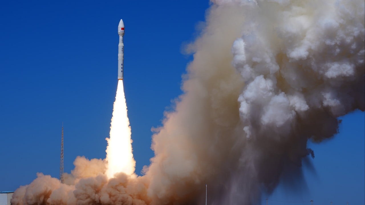
The deployment of the Diting-01 commercial radio-tracking satellite constellation marks a fundamental shift in signals intelligence economics, transitioning high-end radiofrequency geolocation from exclusive military payloads to dual-use commercial architectures. For decades, strategic electronic intelligence collection depended heavily on expensive national security assets deployed in geostationary or specialized low Earth orbits. By embedding radio-tracking capabilities within commercial remote sensing constellations operated by entities such as Chang Guang Satellite, state-backed industrial strategies achieve unprecedented scale and orbital density. This structural convergence alters the cost function of space-based reconnaissance, allowing continuous monitoring of electromagnetic emissions without the budgetary constraints traditionally associated with bespoke military programs.
The Architectural Economics of Dual Use Constellations
Traditional military signals intelligence programs operate under strict budgetary boundaries dictated by unit costs and survivability requirements. Each dedicated electronic intelligence satellite requires heavy shielding, complex propulsion, and classified cryptographic hardware, driving up per-unit manufacturing expenses. Commercial architectures bypass these fiscal bottlenecks through mass production, standardized bus designs, and shared launch vehicles.
When commercial entities integrate radio frequency payloads into small satellite buses, they distribute fixed research and development costs across larger production runs. The Diting-01 trio exemplifies this approach, utilizing networked receiver arrays that perform distributed sensing rather than relying on a single, massive antenna aperture. By receiving the identical electromagnetic transmission from multiple distinct spatial coordinates simultaneously, these small satellites calculate precise emitter locations using time difference of arrival and frequency difference of arrival algorithms.
The financial efficiency of this model generates a severe asymmetry in orbital coverage. Instead of a handful of expensive assets visiting a target region once or twice a day, a commercial constellation provides persistent revisit rates. The capital expenditure required to maintain a comprehensive global electronic order of battle drops significantly when commercial launch providers absorb the logistics of orbit insertion. Therefore, state military planners gain access to high-fidelity signal mapping data funded in part by commercial remote sensing revenue streams.
Electromagnetic Sensing Physics and Signal Interception
Space-based radio frequency detection operates under strict physical laws governing signal propagation, antenna gain, and noise floors. Ground-based radar, communications emitters, and tactical navigation beacons radiate electromagnetic energy outward in specific frequency bands. As these signals propagate through the atmosphere into low Earth orbit, they suffer free-space path loss, atmospheric attenuation, and thermal noise interference.
To extract weak signals from background cosmic noise, satellite receivers require high sensitivity and wide instantaneous bandwidth. The Diting-01 satellites address this through distributed interferometry. When three or more spacecraft sample the same radio frequency emission simultaneously, signal processing algorithms cross-reference the exact phase and arrival time of the wavefront. This multi-point sampling technique overcomes the physical limitations of small antenna apertures on micro-satellites. By correlating phase data across orbital baselines, the system achieves angular resolution capable of isolating specific radar emitters on the Earth surface.
The technical challenge lies in data handling. Radio frequency collection generates massive volumes of raw spectral data that exceed downlink bandwidth capacities if transmitted continuously. Onboard processing units must filter, digitize, and compress signals at the edge, transmitting only localized metadata or high-value intercept snippets to ground stations. This requirement pushes commercial space manufacturers to adopt radiation-hardened edge computing architectures, bridging the gap between civilian commercial hardware standards and military-grade performance requirements.
Defeating Emission Control and Dark Target Tracking
Modern naval and air defense doctrine relies heavily on emission control protocols to evade targeting. Warships routinely power down active search radars, silence tactical data links, and disable automatic identification system transponders to mask their location within cluttered maritime environments. However, complete electronic silence is practically impossible to sustain during complex operations, and even passive systems emit unintended electromagnetic leakage from internal oscillators, power supplies, and digital displays.
Radio-tracking satellites specialize in detecting these incidental emissions. Even when a vessel turns off its automatic identification system transponder, its onboard navigation radars, satellite communication terminals, and tactical radios continue to leak characteristic radio frequency signatures. The Diting-01 constellation is engineered to map these ambient electronic footprints, allowing analysts to reconstruct vessel tracks independently of cooperative transponder data.
When a warship attempts to hide among dense commercial maritime traffic, electronic intelligence satellites filter targets by cataloging unique emitter modulation patterns and pulse repetition frequencies. Each radar model possesses distinct microscopic signal characteristics caused by manufacturing tolerances in vacuum tubes, magnetrons, or solid-state amplifiers. By matching these fingerprints against a comprehensive electronic order of battle database, orbital sensors identify specific hulls despite spoofed or disabled identification signals.
The Data Latency and Fusion Bottleneck in Modern Kill Webs
Detecting an emitter from orbit represents only the initial phase of the targeting chain. To execute a successful long-range strike against a mobile target such as an aircraft carrier or a relocatable missile launcher, the sensing architecture must close the latency loop between initial detection and weapon cueing.
Traditional intelligence workflows involve manual analysis, multi-agency verification, and hierarchical dissemination, introducing delays that render the intelligence obsolete for dynamic targeting. Modern kill webs attempt to automate this pipeline by feeding raw satellite telemetry directly into cloud-based data fusion engines. These systems combine radio frequency intercepts with optical imagery, synthetic aperture radar scans, and historical traffic patterns to generate real-time targeting coordinates.
Yet, this data fusion architecture encounters severe operational friction. Bandwidth constraints between low Earth orbit constellations and ground stations create queuing delays. Even with high-speed optical laser inter-satellite links operating at gigabit-per-second capacities, routing massive spectral datasets through a multi-node mesh network introduces computational overhead. Furthermore, electromagnetic signal ambiguity in congested frequency environments creates false positives. Distinguishing between a civilian communications relay and a hidden military command node requires sophisticated machine learning classifiers capable of parsing complex waveform modulations under adversarial jamming conditions.
Strategic Realignment in Indo Pacific Maritime Warfare
The integration of commercial radio-tracking constellations into operational planning reshapes the strategic calculus across the Indo Pacific theater. Naval task forces operating within the operational range of anti-ship ballistic missiles can no longer rely on radio silence as a primary defense mechanism. The proliferation of persistent, high-density space-based sensors strips away the protective cover of electronic obscurity.
For regional defense planners, this operational environment demands a complete overhaul of electromagnetic doctrine. Traditional methods of frequency hopping, low-probability-of-intercept waveforms, and tactical emission management face diminishing returns when confronted by constellations designed to capture ambient spectrum across broad frequency ranges. Mitigation strategies now require active electronic countermeasures, space-based jamming, and sophisticated decoys capable of generating false radio frequency signatures at scale.
As commercial space ventures continue to blur the boundary between civil infrastructure and military utility, the governance of orbital data streams becomes a critical friction point. The ability of private entities to collect and distribute high-resolution electronic intelligence places commercial satellite operators directly into the calculus of strategic deterrence. The operational viability of surface fleets in future conflicts will depend less on physical concealment and more on the ability to survive in a permanently transparent electromagnetic environment.
To observe how large-scale orbital deployments are coordinated through commercial launch infrastructure, watch this overview on China commercial satellite launch operations. This video provides context on the rapid cadence of small satellite deployment mechanisms that enable high-density constellation architectures.